Alaska and Hawaii: The Newest States
The United States began to acquire Pacific dependencies in the mid-19th century. In 1959, two of these, Alaska and Hawaii, became the 49th and 50th states admitted to the Union. The United States bought Alaska from Russia in 1867 and annexed Hawaii in 1898. The American desire for a Pacii c empire was rooted partly in military interests, which still play important roles in both states. There are large military bases in Alaska and Hawaii, and military ex-penditures contribute much to the economies of both. In their physical geographies, these states are quite unlike one another or the Lower 48—the contiguous U.S. states.
Alaska: Land of the Midnight Sun
Alaska (from Alyeska, an Aleut word meaning “great land”) makes up about 17 percent of the United States by area, but it is so rugged, cold, and remote that its total population was only 670,000 in 2007.
Alaska’s Arctic Coastal Plain is an area of tundra along the Arctic Ocean north of the Brooks Range. Known as the North Slope, it holds the reserves of oil and natural gas that make Alaska the biggest fossil-fuel-producing state in the United States. Alaska hopes to pump natural gas from the North Slope to the Lower 48. To date, the focus has been on oil, which supplies more than 80 percent of the state’s revenues. Oil income has built a hefty surplus known as the Permanent Fund. Interest accrued in this ac-count pays every resident about $1,100 a year just to live in the Union’s harsh but beautiful northernmost state. The cost of living is high in this state, where virtually all foods and consumer goods must be imported.
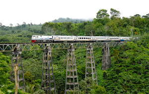
The barren Brooks Range is sometimes considered to be the northwestern end of the Rocky Mountains, with sum-mits ranging in elevation from about 4,000 to 9,000 feet (c. 1,200–2,800 m; xFigure 11.2.33). The Yukon River Basin lies between the Brooks Range on the north and the Alaska Range on the south. The highest mountains are in the Alaska Range, where, about 100 miles (160 km) north of Anchorage, Denali (also called Mount McKinley) rises to 20,320 feet (6,194 m). This is the highest peak in North America. The Yukon is a major river, navigable by river-boats for 1,700 miles (c. 2,700 km) from the Bering Sea to Whitehorse in Canada’s Yukon Territory. In Alaska, the Yukon Basin is generally rolling or hilly, with large areas of l at and often swampy alluvium. Coniferous forest thrives in its subarctic climate.
Fairbanks (population 30,000), on the Tanana tributary of the Yukon River, is interior Alaska’s main town. The Alaska Highway connects it with the Lower 48 via western Canada, while highways and the Alaska Railroad link Fair-banks with Anchorage and Seward. Fairbanks is a service center for the Trans-Alaska Pipeline from the North Slope oil area to the southern port of Valdez. At 64 degrees north latitude, this epitomizes Alaska as the American “land of the midnight sun,” where the sun is above the horizon for 22 hours when summer begins—conditions that allow forsome farming in the Tanana Valley. Cabbages can achieveprodigious sizes in Alaska’s round-the-clock sunshine.
Alaska’s largest city, Anchorage (population 400,000—over half the state’s total population) lies south of theAlaska Range and near the Matanuska-Susitna Valley,one of the few places in Alaska where agriculture is viable. At the southwest, the Alaska Range merges into thelower mountains of the long, narrow Alaska Peninsula and the rough, almost treeless Aleutian Islands. The Aleutians mark the northern edge of the volcanically and seismically active Ring of Fire. Just south of Anchorage, the wildlifeabundant Kenai Peninsula lies between Cook Inlet and the Gulf of Alaska. Still farther to the southwest is Alaska’s largest island, Kodiak, from which a resident subspecies of brown bear takes its name. This southwestern coastal section of the state has a subarctic climate of that is colder than that of Alaska’s southeast.
Alaska’s narrow southeastern portion is known as the Panhandle. The mainland ranges of the Panhandle are an extension of the Coastal Mountains of British Columbia, and there are many mountainous offshore islands. The state’s capital, Juneau (population 30,000), is located in the Panhandle. Juneau is the only U.S. state capital not reachable by road, but a proposed (and locally controversial) highway to Skagway may change that.
The spectacular Inside Passage from Seattle and Vancouver to the Alaskan Panhandle lies between the islands and the mainland. It is a popular route for cruise ships, as some of the world’s most magnii cent glaciers and mountains may be seen on its shores. On the mainland, some mountain peaks rise more than 15,000 feet (4,575 m). Fjorded valleys extend their long arms of the sea inland. A cool and wet marine west coast climate prevails, favoring coniferous forests.
The general trend all over Alaska in recent decades has been toward warmer temperatures, with the average annual temperature increasing by 3.4°F (1.8°C) between 1949 and 2006. This trend has had signii cant impacts on the state’s oil industry, cutting in half the number of days that industry vehicles are allowed to cross the tundra. There are other effects, too—for example, coniferous forests are sinking into areas where permafrost has melted, and river temperatures increased by nearly 10°F (4.5°C) between 1984 and 2007, driving salmon from their traditional habitat.
Native Alaskans are being hit particularly hard by problems attributed to global warming. Erosion and l ooding in the wake of permafrost melting, late-season ice formation, and land subsidence is affecting an estimated 184 of 213 Native Alaskan villages. Many communities are being compelled to relocate, in the midst of uncertainty about who will pay for the move and what people will do in their new locales. Most villages have supported a subsistence livelihood of i shing and hunting for generations, and the sudden disruptions come as a great shock.
Alaska’s Ups and Downs
After about 200 years of rule by Russia and the United States, the population of Alaska was still only 73,000 in 1940. Eighteenth-century Russian fur traders lived in small numbers along the southern and Panhandle coasts. Their legacy remains in Russian place names and Russian Orthodox churches on the landscape. In 1812, Russians established an agricultural colony on the California coast at Fort Ross, north of San Francisco Bay. They abandoned this attempt to better provision their Alaskan posts in 1841. Six years later, Russia sold remote and unproi table Alaska to the United States at 2 cents per acre. Many Americans derided the transaction as Seward’s Folly, after William Henry Seward, the American secretary of state who negotiated it. The value of oil pumped every day in Alaska now exceeds what the United States paid for its vast new territory.
By the time the United States bought Alaska, hunting had nearly wiped out the sea otters, whose costly pelts were the main incentive for Russia’s Alaskan fur trade (their population has since bounced back). There was a burst of American settlement during gold rushes in the 1890s. Then came only a slow increase from military, i shing, and log-ging settlements. Most of the state’s commercial logging is in the Tongass National Forest of the Panhandle region, but it is unproi table and is maintained only by costly and controversial federal subsidies.
Beginning with World War II (when Japanese troops succeeded in invading the Aleutian Islands), Alaska’s growth became more rapid. Growth came from military and governmental employment (the federal government spends more money in Alaska per capita than it does in any other state), i shing (for king crab and for wild salmon esteemed for not having the contaminants common in farmed salmon), tourism, and especially the boom in the oil industry after the 1973 energy crisis. Alaska has lived though a series of boom and bust cycles, with the booms always related to its natural resources. With oil production in decline, many Alaskans are asking what the next big boom might be. There is no readily apparent prospect on the horizon, and a few Alaskans are beginning to ask how the state might pursue a path of more sustainable growth.
About 15 percent of the state’s residents are Alaska Natives (Inuit or Eskimos, Native Americans, and Aleuts). Long the victims of exploitation and neglect by whites, these peoples received some redress in large land grants and cash payments under the Alaska Native Claims Settlement Act passed by Congress in 1971. Alaska’s population is aging, and it does not appear that natural increase will raise the numbers of young people much. The quest for opportunity and adventure in a remote land has attracted many more men than women (there are 107 men for every 100 women in Alaska, compared with the national U.S. i gure of 97 men for every 100 women). The single woman’s prospects have been described this way: “In Alaska, the odds are good . . . but the goods are odd.”
Hawaii: America in a South Seas Setting
The state of Hawaii has eight major tropical islands lying just south of the Tropic of Cancer about2,000 miles (3,200 km) west of California. Created by the movement of the Pacii c plate of the earth’s surface across ageologic hot spot, the islands are all volcanic in origin and largely mountainous . They have a combined land area of about 6,400 square miles (c. 17,000 sq km), a bit larger than the combined areas of Connecticut and Rhode Island or the European nation of Slovenia. The island of Hawaii is the largest and the only one with active volcanoes. The prevailing trade winds and mountains produce extreme precipitation contrasts within short distances. Windward slopes receive heavy rainfall throughout the year, rising to an annual average of 460 inches (1,168 cm) on Mount Waialeale on the island of Kauai. One of the wettest places on the globe, lush Kauai stands in for many tropical locations in Hollywood i lms. Nearby leeward and low-lying areas receive as little as 10 to 20 inches (c. 25 to 50 cm) yearly. Some areas are so dry that crops require irrigation. Temperatures are tropical except for colder spots on some mountaintops. The capital, Honolulu (on the island of Oahu; xFigure 11.2.35), averages 81°F (27°C) in August and 73°F (23°C) in January.
Hawaii’s population in 2007 was 1.2 million, with about 900,000 people living in metropolitan Honolulu. Immigration from the Pacii c Basin has given the state’s population a unique mix by ethnic origin: 24 percent white, 17 percent Japanese, 14 percent Filipino, 6 percent native Hawaiian, 5 percent Chinese, and smaller proportions of Koreans, Samoans, and others. Although there has been tension between native islanders and immigrants from the U.S. mainland and East Asia, much ethnic mixing has taken place.
As noted in Chapter 11 (page 611), the United States over-threw the Polynesian monarchy of Hawaii in 1893. Congress formally apologized to Hawaii in 1993 for wrongfully ejecting its indigenous rulers and promised to reconcile with the native Hawaiians. The Native Hawaiian Government Reorganization Act, first proposed to Congress in 2000, would go much further, extending sovereignty to native Hawaiians. This would give them the same legal standing as American Indians and native Alaskans, allowing them, among other things, to negotiate the fate of a large amount of land held in trust by the federal and state governments. A small nationalist movement is calling for the independence of the Kanaka Maoli, as the native Hawaiians call themselves.
Hawaii’s economy is based largely on military expenditures, tourism, and commercial agriculture. The main defense installations, including the Pearl Harbor naval base, are on Oahu. The main agricultural products and exports—cane sugar (with a new use as an ethanol source) and pineapples—have long been grown on large estates owned by white families or corporate interests but worked mainly by Asians. New immigrants often took their first job on these estates. Agriculture now accounts for only about 1 percent of the state’s economic productivity.
Propelled by better air transport and more wealth on mainland America and East Asia, tourism has been the great growth industry of recent decades. Attractions include tropical warmth, beautiful beaches, spectacular scenery, exotic cultures, and luxury resorts. Some of the “South Seas” glamour of the islands has been inevitably eroded by the relentless spread of commercial and residential development.
By some measures, Hawaii’s natural environment has been altered more than that of any other state, with the highest proportion of native plant and animal species losing out to exotic competitors. Hawaii has even earned the unenviable title of being the “extinction capital of the world.” Hawaii has the last word in this text: aloha!
from: Worldmark Encyclopedia of the Nations, Eleventh Edition