Physical Geography: Luxembourgh
Luxembourg
- Official name: Grand Duchy of Luxembourg
- Area: 2,586 square kilometers (998 square miles)
- Highest point on mainland: Buurgplaatz (559 meters/1,834 feet)
- Lowest point on land: Moselle River (133 meters/436 feet)
- Hemispheres: Northern and Eastern
- Time zone: 1 p.m = noon GMT
- Longest distances: 57 kilometers (35 miles) from east to west; 82 kilometers (51 miles) from north to south
- Land boundaries: 356 kilometers (221 miles) total boundary length; Belgium 148 kilometers (92 miles), France 73 kilometers (45 miles), Germany 135 kilometers (84 miles)
- Coastline: None
- Territorial sea limits: None
1. LOCATION AND SIZE
Luxembourg, one of the world’s smallest countries, is a landlocked nation located at the heart of Western Europe. Together with Belgium and the Netherlands, it is part of a group known as the Benelux countries (formerly the Low Countries). With an area of 2,586 square kilometers (998 square miles), it is slightly smaller than the state of Rhode Island.
2. TERRITORIES AND DEPENDENCIES
Luxembourg has no territories or dependencies.

3. CLIMATE
Luxembourg has a temperate climate, with cool summers, mild winters, and plentiful precipitation. The city of Luxembourg, in the south-central part of the country, has average temperatures of 0.6°C (33°F) in January and 17°C (63°F) in July. In the Oesling region to the north, temperature averages for both seasons are somewhat lower. The Moselle River Valley in the east has an especially pleasant climate, which has led to its nickname of “Little Riviera.” Rainfall, which varies from about 76 centimeters (30 inches) to 127 centimeters (50 inches) annually, is generally heavier in the north.
4. TOPOGRAPHIC REGIONS
Despite its small size, Luxembourg’s terrain varies considerably and includes parts of three diferent topographical areas: the Lorraine plateau of northern France, the foothills of Belgium’s Ardennes Mountains, and Germany’s Moselle Valley. The intersection of these features carves Luxembourg into two major geographic regions. The northern third of the country, known as the Oesling, is a plateau region belonging to the Ardennes system of southeastern Belgium. The southern two thirds, known as Gutland, or the Bon Pays, is a region of lower elevation consisting of hills and broad valleys.

5. OCEANS AND SEAS
Luxembourg is landlocked.
6. INLAND LAKES
The most important lake is the Upper Sûre Lake, situated on the course of the Sûre River as it winds across the upper portion of the country. Esch-sur-Sûre is located at its eastern end, which is the site of both a nature reserve and a hydroelectric dam.
7. RIVERS AND WATERFALLS
Luxembourg’s major rivers are the Moselle, the Sûre, and the Our, which together form its border with Germany. The Moselle, which originates in France and has a total length of 515 kilometers (320 miles), demarcates Luxembourg’s eastern border for 31 kilometers (19 miles). The Sûre, which rises in Belgium, flows eastward across Luxembourg in a meandering course for 172 kilometers (107 miles), gathering tributaries from both the northern and southern parts of the country before reaching the German border and then flowing southward into the Moselle. In the south, the Alzette River flows northward through the center of the country until it reaches the Sûre.
8. DESERTS
There are no deserts in Luxembourg.
9. FLAT AND ROLLING TERRAIN
The southern two-thirds of Luxembourg consists of fertile, gently rolling land with an average elevation of about 229 meters (750 feet). The Moselle River Valley in the east is known for its vineyards, and there is a mining region to the southwest, near the border with France.
10. MOUNTAINS AND VOLCANOES
The highest point in Luxembourg’s uplands, and also in the country as a whole, is Buurgplaatz, at 559 meters (1,834 feet).
11. CANYONS AND CAVES
The Hoestrof Cave is 4,000 meters (13,124 feet) long.
12. PLATEAUS AND MONOLITHS
The Ardennes region that forms Luxembourg’s northern uplands consists of a plateau that has an average elevation of 450 meters (1,500 feet) and is deeply carved by the valleys of the Sûre River and its tributaries.
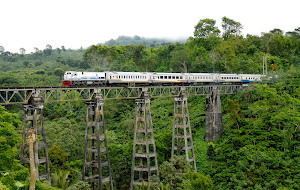
13. MAN-MADE FEATURES
Luxembourg’s hills and plateaus are connected by numerous bridges, which are especially prominent in the capital city. Bridges in the capital include the modern Grand Duchesse Charlotte Bridge, popularly known as the Red Bridge; the seventeenth-century Vaubon Bridge; the late nineteenth-century Pont Adolphe, once the world’s longest single-span stone bridge; and the Pont Victor Bodson.
Source:
JUNIOR WORLDMARK ENCYCLOPEDIA OF PHYSICAL GEOGRAPHY Vol. 3, Karen Ellicott and Susan Bevan Gall


0 komentar:
Posting Komentar